Monday, December 27, 2010
Tuesday, August 17, 2010
Table Cliff Plateau, Utah
 In under three hours we were able to drive from Parowan to the top of the Pine Lake Road on the edge of the Table Cliff Plateau. After a hot week in the low country, the temperatures at 10,000 feet were comfortable and we quickly found a place to camp along the rim. We had views from the Henrys to the Markagunt, with everything in between. At night, we could see the lights of Page.
The road up to the plateau had washed out in a couple of places (like it does every summer), forming an RV barrier and giving us a quiet camp. The ATVs went by on the road for a while, but even they quit at dusk. (And, nothing can be as bad as the motors on the Markagunt, where half of Las Vegas seemingly lives all summer. Between the yuppies and the yayhoos, there is not one quiet corner . . . isn't anybody lonely anymore?)
On Sunday morning we worked our way out to Powell Point, which is probably one of the best places on Earth. The light was spectacular and all of southern Utah was in view. No wonder JWP found it a good place to pursue his map-making. After a while we began to hear the maggots on the trail and decided to start the trip back. On the way out we pulled over for an ATV carrying four, including one kid on the hood. The lady driving asked us how far it was, and whether it was worth it. I answered, "It's beautiful." But, after they drove on, I realized that what I should have said was, "Naw, it's not worth it."
Tuesday, July 6, 2010
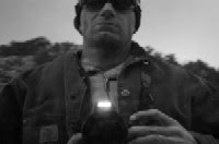
Virgin River Rim, Utah
 Mark came down from Park City to spend the holiday weekend in southern Utah. We've been interested in learning more about some of the local mountain biking trails, so we saw this as the perfect opportunity. With Mark here, we'd have someone to drive the sag wagon, carry the water, and clear the trails of deadfall. In exchange, we just needed to provide a place for him to sleep and some beer to drink. (Of course, now that I think about it, he brought the beer, too.)
First, Mark and Valerie rode Bunker Creek. On Saturday afternoon, they drove to the top of Brian Head Peak and started the ride while Ellen and I napped. When we awoke, we drove over to Panguitch Lake to pick them up. Thinking that the right fork of Bunker would be smoother and less technical than the left fork, they rode that side. I guess it was choked with downed trees and the afternoon became more of a walk and carry than a ride. In any case, they made it to Panguitch Lake right on time and we all sat by the water for a while drinking beer while Ellen waded in the shallows.
Next, Mark and I rode the Virgin River Rim Trail. We had Valerie drop us at Strawberry Point on Sunday morning, while leaving Mark's truck at Te-Ah Campground near Navajo Lake. The stage was set for 20 miles of single-track riding. And what a gorgeous 20 miles it was. Averaging between nine and ten thousand feet with constant views of the Pink Cliffs, the Virgin River Headwaters, and Zion National Park, the trail was challenging, but fun. We rode through bristlecone and limber pine forests, through aspen stands and meadows, and through skeletons of subalpine fir and dead spruce. Some sections of the trail were rocky and loose, but mostly it was excellent for mountain bikes and free of ATVs.
The main problem with the day, however, was that my legs were in shape for ten miles of riding, not 20. Spending most of the last five years sitting behind a desk was not the best preparation for a long rocky trail ride that included several four or five hundred foot climbs. Let's just say I bit off more than I could chew. Mark was in fine shape and could probably have finished the whole thing in four or five hours, but I forced us to bail off the single-track at the Navajo Lake Campground to complete the last few miles on pavement. In short, I was an embarrassment to myself and everyone.
Aside from this single episode of bonking, however, the weekend was a success. We had a great time talking with Mark (especially Ellen), learned a lot about the local biking trails, and didn't have to drive our own shuttles. Hopefully there will be opportunities to do the whole thing again soon. Next time though, in addition to the beer, we'll need to remind Mark to bring a bicycle tow rope that can be attached to my fork.
This week's photo credits: Mark Saurer.
Tuesday, June 22, 2010
Yankee Reservoir
 Valerie recently purchased a beat-up old Disco 169 to use for family paddling. I wasn't necessarily supportive since southern Utah isn't really the place for a canoe. I mean, where are you going to use it? Well, Yankee Meadows, for one. Yesterday we went up to the reservoir and had a canoe-in picnic. If you like to bait fish from the back of your pick-up truck, this is the place for you. As a result, it wasn't, um, the most quiet and pristine canoeing experience, but it was a beautiful evening and the girls enjoyed the time outdoors. Since we can be loaded, up the mountain, and on the lake in thirty to sixty minutes, I suspect that we will see a lot more of Yankee in the weeks to come.
Sunday, May 2, 2010
Cannonville, Utah
 It could have been worse. When we first decided to do the trip, I thought we'd camp at Rock Springs Bench. But with snow in the forecast, Dr. Kelly pulled the trigger on a couple of cabins at the Cannonville KOA. It was a good call. The biting north wind blew all weekend and my stove was so coated with ice this morning that I couldn't get it started. If we'd been out on the Monument with three kids and a wind chill in the teens, it would have been a true suffer-fest.
As it was, we were relatively well rested and nourished for a tour of all the popular Cannonville sites. (Actually, we skipped Kodachrome, which I will leave to Kelly and Martin to accomplish on their own.) We started with Bull Valley Gorge, which I had not properly scouted, and soon found that it was too difficult for the kids (and probably for me, too). Martin made it to the bottom, but wisely decided to turn aound at the first bad waterfall. Instead, we went back to Willis Creek and enjoyed about a mile and a half of splashing while the women ran down to Sheep Creek. After an afternoon nap, we all piled in for a trip to the ghost cabin in Pardner Canyon. There we encountered a bit of a rat attack, but made it back to the KOA in time to welcome forty Frenchmen.
After a cosy night while the wind and sleet battered the cabins, we huddled over the rime covered stoves trying to coax enough hot water out of them for a taste of coffee. Kelly commented that, "You know it's cold when you set something down that's been in your cooler and it melts the ice on the picnic table." We eventually rallied for the trip down to Grosvenor Arch. It seems like Kane County hasn't graded that road for about a decade and it was as rough as I remember it. After a good time of hiking, climbing, and playing, we turned south towards Big Water, while Kelly, Martin, Quentin, and Landon headed back to Salt Lake. We went only as far as the trailhead for the Cottonwood Wash narrows and did a short hike down and back. The bitter wind had limited the crowd of tourists to about 30, but I can imagine that the line-up on a nice June day is about 10 times that number. I thought about going down to Big Water, and then home through Kanab and Glendale, but decided not to spend that much time on the highway. We went back to Cannonville and made it home before dinner.
Wednesday, April 21, 2010
San Rafael Swell, Utah
 We live near the freeway now and can, theoretically, be atop the Sevier Plateau east of Richfield in about two hours. From there, it is just a matter of picking an exit on the way down and finding oneself in the San Rafeal Swell. Unfortunately, the Chev won't tow the camper three or four thousand feet uphill at freeway speed, and the pavement ends at the bottom of every one of the Swell's exit ramps. All of which is to say that it took us about six hours of driving to make it from Parowan to the Red's Canyon overlook on Link Flat.
It was time to camp. And what a camp it was. One of the best places I have ever camped in my life, which is saying something. We were too far off the beaten path for any other campers, there were no cows, and we could see all the way to Mt. Ellen. Aside from two parties of drive-bys and one BLM guy, we didn't see anyone else the whole weekend. The silence was golden.
On Sunday my plan was to leave Link Flat headed east and follow the "main" road up to the Copper Globe Mine and Justensen Flat. I wanted to see if we could tow the camper out that way. In addition, I thought we could look around the Mine and maybe hike down Devil's Canyon. Unfortunately, the road leaving Link Flat goes up and over a couple of hogsbacks. It is very ledgy and I finally quit on one I wasn't sure the Chev could clear. A guy in a nice jeep came by and struggled a little with it while I was standing there. That was enough for me. We turned around and went back the other way.
On Monday we went down Cat Canyon and Kimball Draw to the freeway. Ellen slept after we got to Richfield. We were back in Parowan by 3p, dusty and worn, but glad we'd made the effort.
Thursday, March 25, 2010
Deer Valley, Utah
 In contrast to my earlier post, it turns out that I can park at Deer Valley. In fact, when I'm with Saurer, I can even ski there. We got started sometime before noon last Friday morning and I quickly reached into the bag of tricks labeled "New England." I didn't see any true ice like we used to ski in Vermont, but that was some hard snow for Utah. After skidding through a couple of groomers, we ventured onto Morning Star, which looked terrifying. Turns out that it wasn't too bad and a little sun had softened some of the worst of it. We took a bunch of laps in there and Mark enjoyed the shrubs, which is not a love that we share.
Afterwards we toured the rest of the mountain. Remarkably, the Empire Lodge, which I never considered to be a small structure, has now been absolutely dwarfed by one of the largest hotels I have ever seen. All I can say is that there are quite a few people who have more money than I do. In fact there may be quite a few people who will spend more money at that hotel than I earn in my lifetime. In any case, we finished our day in the Daly chutes. Saurer laid down a few of his famous jump turns. As for me, all I can say is that there is no shame in a side slip. Actually, that wasn't quite the end of our day because we had cookies, cheese sandwiches, and beer in the parking lot before leaving Deer Valley.
I needed to be back in southern Utah by Saturday afternoon, but Cylvick objected to an early departure, so I joined he and Stan for a few laps at Park City. It was an absolutely beautiful morning, but I left the camera behind. (Let's just say that Cylvick isn't known for his patience.) We started in Scots, skied the West Face, and then met Saurer on top of the Peak. The snow right off the top above First Chute was pretty nice, but the frozen chicken heads down in the bottom of the bowl wore me out. When Eric and Stan called it a day, I skied a front side lap with Kristi, who had apparently forgiven me for the 21-pot-salute I gave her at 6:30a. I was on the road by 12:30 or 1p and back in southern Utah in time for dinner. Another good Park City ski holiday.
http://picasaweb.google.com/aorlemann/DeerValleyUtah#
Sunday, March 14, 2010
Denver International Airport, Colorado
 I was in Fort Collins last week. The weather was poor, the work days were longish, and my motel was surrounded by traffic. I usually try to find an out of the way corner; some place derelict or abandoned or unnoticed; a place for walking around, making pictures, and feeling lonely. But I had no luck until Friday afternoon when we drove down to DIA for our Saturday flight. It was there, at a box-like motel on the edge of the airport that I found what I was looking for. The place is developing quickly—a few acres of condos here, an office park there, a couple of Marriotts over on the other side—but not that long ago it was just a bunch of ramshackle farms on the edge of the Great Plains. And, where it hasn't yet been paved, the prairie is still the prairie. I walked out behind the hotel into a field of weeds, across what was once a country road, and over a pipeline right-of-way. The wind blew cold, the sun was setting, and the fields were muddy with trash and dried grass. But, the larks were back . . . , and the hawks, and the sparrows. I squatted down so I couldn't see the sprawl, and I listened to the song of a lark and watched a hawk hunting. I felt a little better then, more like myself, more like I could tell what was going on in the world.
Tuesday, February 16, 2010
Skiing Brian Head
 I went downhill skiing this week at Brian Head Resort. Brian Head is a medium sized ski area on the slopes of, you guessed it, Brian Head Peak. Brian Head is located about 12 miles from Parowan. The mountain is 11,300 feet high, and the resort sits just below the summit making it perhaps the highest resort in Utah. The ski area claims 650 acres of terrain, eight chair lifts, and 400 inches of snow annually.
In my opinion, Brian Head is the perfect family ski resort. It has plenty of wide-open cruising terrain, torrents of southern Utah sunshine, and a low-key atmosphere. Sometimes a smaller, family-type resort can be a bit ramshackle, and things like grooming can be an afterthought. Not so at Brian Head. I think the quality of the grooming was the best I’ve ever seen—and I’ve skied Deer Valley, which is famous for its perfect corduroy. On top of the good conditions, there is the view. From 11,000 feet atop the Markagunt Plateau, the clear weather and long views are spectacular—Zion to the south, the basin and range country of Nevada to the west. It is a beautiful place. Finally, at least on the day I was there, the aggressive gang skiing and snowboarding was nowhere in evidence. I’m not saying it never happens, but I didn’t see the out-of-control, near misses that are common at the larger resorts. Brian Head just doesn’t attract the aggressive skiers. Partly this is because the terrain is not challenging. While this can be considered a good thing, it also leads my main complaint about the resort.
Brian Head has plenty of good cruising terrain, but it has almost nothing steep. If you are an expert skier looking for a challenge, you will quickly be bored. That is not to say that you can’t enjoy a day poking around. I had three or four good runs to the skier’s left of the Alpen Glow lift in some fairly steep trees full of soft powder. There is also one steep shot at Devo’s Pitch that requires a couple of jump turns. Once you’ve dropped in, however, there are only about three or four turns left before you’re in the flat. This is another problem with the steep pitches at Brian Head, they are very short and are often followed by long flats. If you don’t want to be walking, you’d better limit your turns so you can carry your speed through the valleys.
One caveat to all this is that I did not hike the peak. There are some very nice looking shots off the top of Brian Head Peak, some of which had been skied since our last storm. These are steep, challenging, expert only, “out of bounds” chutes that look like quite a bit of fun. Accessing them requires, however, a significant and lengthy hike from the top of the Giant Steps chair lift. Since I was alone and don’t know the mountain well, I wasn’t inclined to set out hiking by myself. When I get a chance, I’ll go back and give them a try. Unfortunately, even if they turn out to be good runs, they are too small and too inaccessible to make Brian Head truly a mountain for expert skiers. For half the effort, I can ski ten times the terrain at Snowbird or Alta.
In short, had a very good day at the mountain. The grooming was superb, the snow conditions were excellent, and the slopes were uncrowded. I wouldn’t hesitate to take Valerie and Ellen. I would not, however, recommend Brian Head to the “extreme” skier. It has a few challenging runs, but the terrain is mostly gentle to moderate. If you really need to go big, you’d better go north. How about Alta . . . have I mentioned Alta?
Sunday, January 17, 2010
Deer Valley, Utah
 We skied Deer Valley yesterday. (No, not that Deer Valley. Are you kidding, they probably wouldn't let us park in the parking lot?) Deer Valley is a small nordic ski area on the Markagunt Plateau. It is on the Cedar City Ranger District of the Dixie National Forest. National Forest employees have cut and marked trails, and have worked mightily to keep the motors out. Plus, in the last week or two, someone on the Forest came up with a groomer. When we were there yesterday, all the trails were freshly groomed. It was very comfortable skiing. Unfortunately, the light was flat and the scenery was, well, somewhat monotonous. Of course, it was a lot like skiing in northern Wisconsin . . . which has great appeal to some of us. For me, however, it won't be quite the same until I find a tavern with Old Style on tap.
Subscribe to:
Comments (Atom)